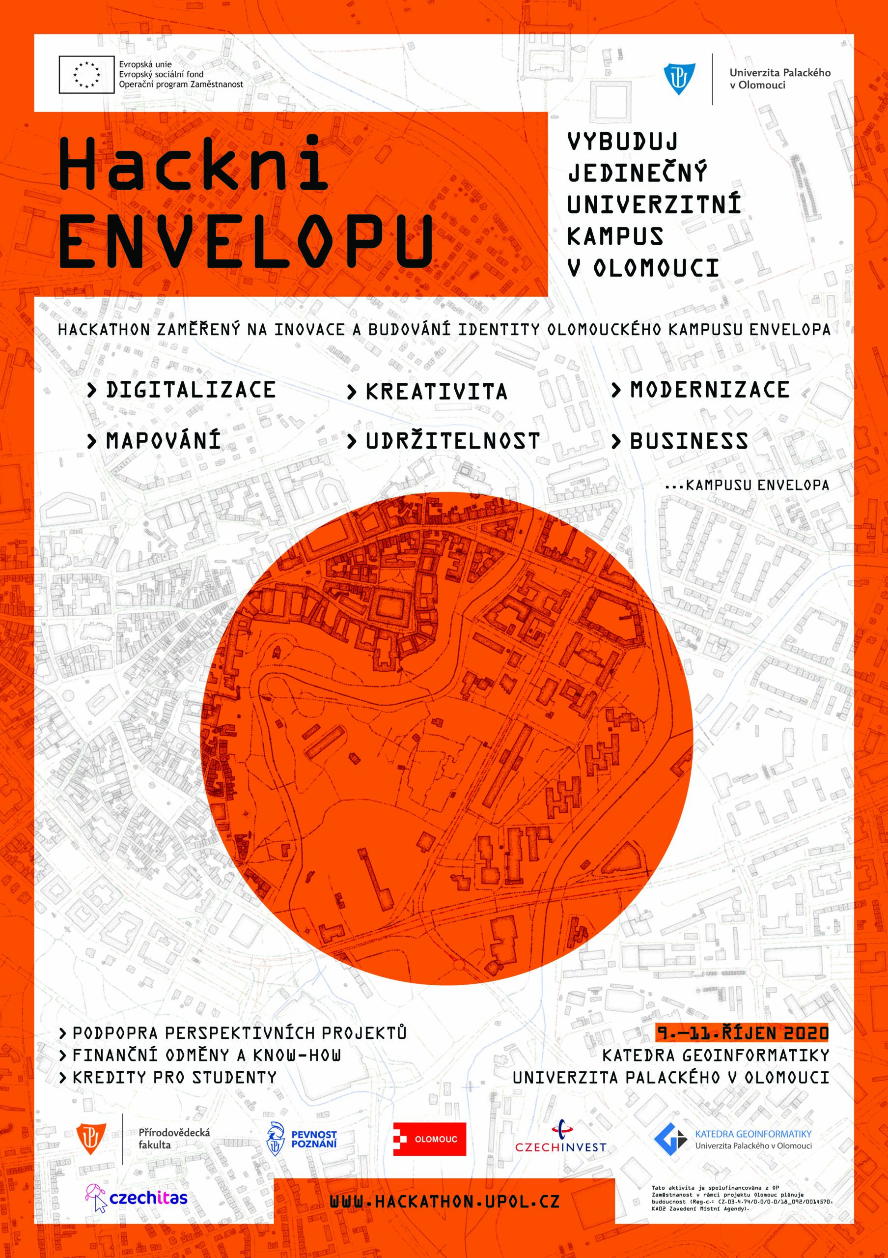
Hackathon

Hackni Envelopu

In name of Department of Geoinformatics, Palacký University Olomouc, we organize hackathon oriented to innovations in campus Envelopa in Olomouc. This area is around the Faculty of Science building and includes dormitories, cantine, city park, science centre and much more.

According to visual material, I created all graphic materials and promos with usage QGIS and Adobe Photoshop. Thanks to Topi Tjukanov style – pencilish, I created background with buildings of Olomouc. 

All of you are invited: https://hackathon.upol.cz/


Koňo

Joy Division style

Joy Division – Olomouc region

QGIS styling of Olomouc region elevation – quite flat at all 🙂 For the very first time I tried style a map in Joy Division – just with lines indicating elevation. It is not perfect but this output took me about 10 minutes.

Quick workflow:

  • Extract elevation data by mask
  • Generate grid or random points in extend
  • Install plugin Point Sample Tool
  • Use it for sampling raster values into points
  • Translate rvalues in y-coordinate
  • Use Point to Path, order by „left“ and group by „top“ attribute
  • done 🙂


Koňo

The nearest country

The nearest country to you
across the Czechia & Slovakia

Some QGIS work with OSM data again. I used layers/polygons of European countries and filled Czechia with random points. Borders had to be converted to lines and transformed to vertexes. Using the function Distance to nearest hub I was able to find out the closest border to each random point. For the visualization, I used and edited (a little bit) QGIS styles involved by Topi Tjukanov and Klas Karlsson


Koňo

OSM Olomouc

Roads, waterways, buildings

Pretty simple symbology edit of Open Street Data in QGIS and Photoshop makes quite nice-looking map/art/picture. I used it already for a New Year wish card two years ago.


Koňo

New QGIS Styles

New QGIS Styles

Thanks to Topi Tjukanov and his brand new QGIS Styles I was able to create the following visualizations. I used an unique Qlimp and Pencilish style. The second one had to be reedited for usage at lines. Both maps were edited in Adobe Photoshop afterwads. Olomouc region map uses for visualization the basic settlement units and for Olomouc city is used OSM layer of buildings and roads.  


Koňo

Jakub Koníček
Olomouc | Nová Dubnica
IČ: 10944443